
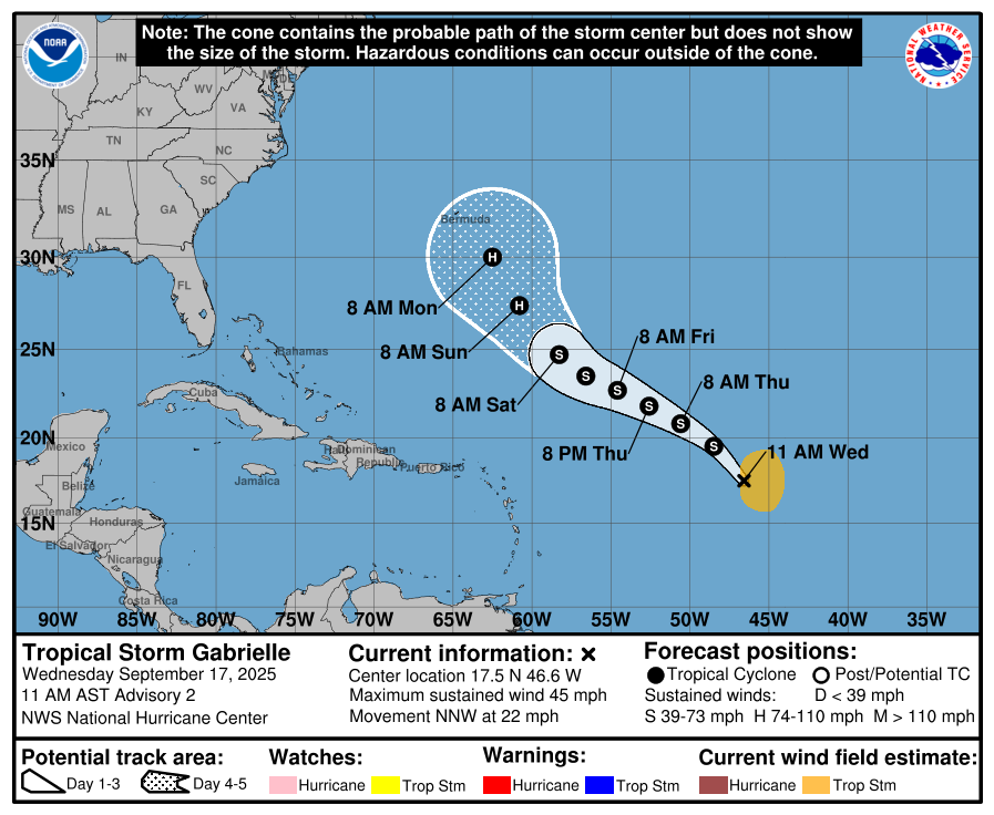
The National Hurricane Center Wednesday morning named a disturbance in the central Atlantic Tropical Storm Gabrielle.
It's the first named storm in September, historically the most active month of the season.
The good news for Osceola County, Florida and the U.S. coastline is that all major computer models forecast Gabrielle, while becoming a hurricane early next week, to curve north into the Atlantic and only potentially affect Bermuda, although as the NHC reported in its 11 a.m. storm discussion, "This is a highly uncertain forecast until a better defined center forms."
But, in a sign the tropics may be heating up, the NHC is monitoring a new tropical wave that just exited the African coast located near the Cabo Verde Islands. Right now it has a low chance of development soon (20% in the next 7 days).
"Any development of this system should be slow to occur while it moves westward at 15 to 20 mph across the eastern and central portion of the tropical Atlantic," the NHC said.
Long-range models don't show any well-organized systems entering the Caribbean in the next 7-10 days. Those models do hint at some low-level development that could bring Florida some added rain at the start of October.
The moral — nothing to stress about now in the tropics, and we'll let you know if that changes.