
NHC has began advisories on what's expected to be major Hurricane Helene


Watch the weather, Osceola County residents, and be ready to act in case we are subject to storm conditions from a developing tropical system.
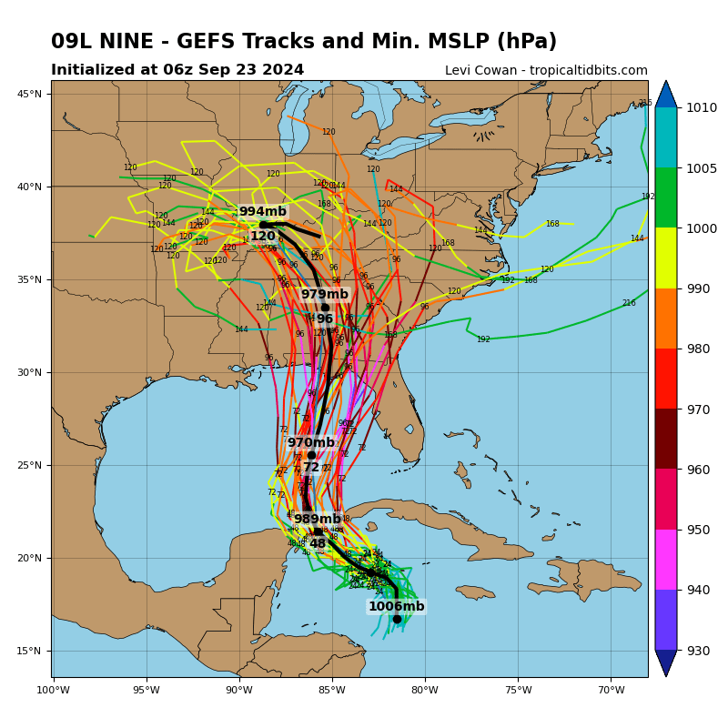
The National Hurricane Center, and the global models it uses to forecast storms, all agree that a disturbance now in the western Caribbean will form and strengthen into a major hurricane that could impact the Gulf-facing Florida coast directly between Tampa and Panama City.
At 11 a.m. Monday, the NHC began issuing advisories on what it's calling Potential Tropical Cyclone 9. It has yet to form a center of circulation, so it wasn't a depression at that time, but it is expected to strengthen in time to bring storm conditions to the Yucatan Peninsula of Mexico and western Cuba.
(Mexico has issued a Tropical Storm Warning for the Yucatan Peninsula from Rio Lagartos to Tulum, and a Hurricane Watch from Cabo Catoche to Tulum; Cuba has issued a Tropical Storm Warning for the Isle of Youth, Artemisa, and Pinar del Rio, and a Hurricane Watch for Pinar del Rio.)
All of the trusted models bring the storm to a Category 3 or 4 with top winds of 100-130, and, as of that first advisory, projecting a landfall of those conditions between Apalachicola and Cedar Key. If this holds and verifies, Osceola County would likely experience impacts much like we got from Hurricane Idalia of last year — which closed schools locally for a day — and Debby earlier this year.
New model data will come out just after 2 p.m. While Osceola County isn't in that initial NHC "cone", keep in mind that since there is no center of circulation yet, there is higher than usual uncertainty in the forecast, something the NHC addressed in the first storm discussion advisory.
"Since the disturbance currently lacks a well-defined center, users are reminded that the average forecast track uncertainty is larger in these situations, and future track adjustments may be required," Forecaster Brad Reinhart said. "Given the large size of the tropical-storm-force wind field and fast forward speed that is forecast, storm surge, wind, and rainfall impacts will likely extend well away from the center, particularly to the east of the system."
Uh, that'll be us. The east side is considered the "dirty side" of a hurricane with elevated risk for tornadoes. Effects we'd feel from it will be the basis of Thursday.
"This one has trouble written all over it," said Mark Suddeth, a veteran storm tracker and hurricane hunter at Hurricanetrack.com.
This also from the NHC discussion: "Although it is too soon to specify the exact location and magnitude of impacts, residents in these areas should monitor the latest forecast updates and ensure that they have their hurricane plan in place."
You do that too, Osceola.