Keep an eye to the skies heading into next week, folks.
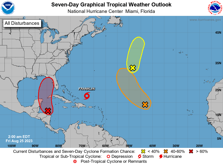
The National Hurricane Center is giving a tropical wave forming east of the Yucatan Peninsula in the southwestern Caribbean Sea a 70 percent chance of becoming a tropical depression in the next seven days (20 percent in 48 hours), and weather models are saying that a tropical storm -- at least -- could form in the Gulf of Mexico and be affecting Florida by Tuesday night and into Wednesday. Those Gulf waters are super-warm, in the high-80s, providing fuel for a developing tropical system.
"Interests in the Yucatan Peninsula of Mexico, western Cuba, and Florida should monitor the progress of this system," the NHC said in a Tropical Weather Outlook Friday morning.
What will it be? From T.F. Walsh, who monitors tropical development online out of the Tampa area: "The ECMWF EPS (European model) cyclone formation probability model indicates a high probability of a tropical depression over the next 72–96 hours, a medium range projection for a Tropical Storm around days 5–7, and a low probability of a Hurricane by days 6–7."
Gov. Ron DeSantis directed the state Division of Emergency Management to prepare for a storm that could affect Florida next week. “Residents should remain vigilant and prepare for possible impacts early next week,” DeSantis said in a post on X, formerly Twitter.
This system should not keep you from enjoying your weekend plans. Highs are expected to be back up, as high as 95 Saturday and Sunday, with low chances of rain around 20-30%. By late Sunday into Monday, the forecast will be more clear. As a tropical storm or a minimal hurricane, local impacts would likely be a one to two-day period of heavy rain that could lead to flooding. So STAY TUNED and stay nimble in case things change, and storm plans have to.
The next storm name would be Idalia -- it's a new name after Irma (vaguely remember that storm?) was retired after the 2017 storm season.