
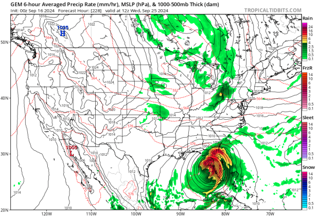
The Canadian forecast model shows a potential hurricane -- albeit at 222 hours, when forecast models are of low confidence -- affecting the west coast of Florida on Sept. 25. GRAPHIC/TROPICAL TIDBITS
After a bit of activity, the tropics have settled in a "normal" mode for September, with a named storm churning, a potential one that could affect land as a tropical storm, and plenty other potential for development as we move through the peak portion of storm season.
Tropical Storm Gordon continues to meander through the Central Atlantic, but is fighting dry, stable air. It is expected to turn into the open sea, in fact the National Hurricane Center has declared, "Gordon poses no threat to land."
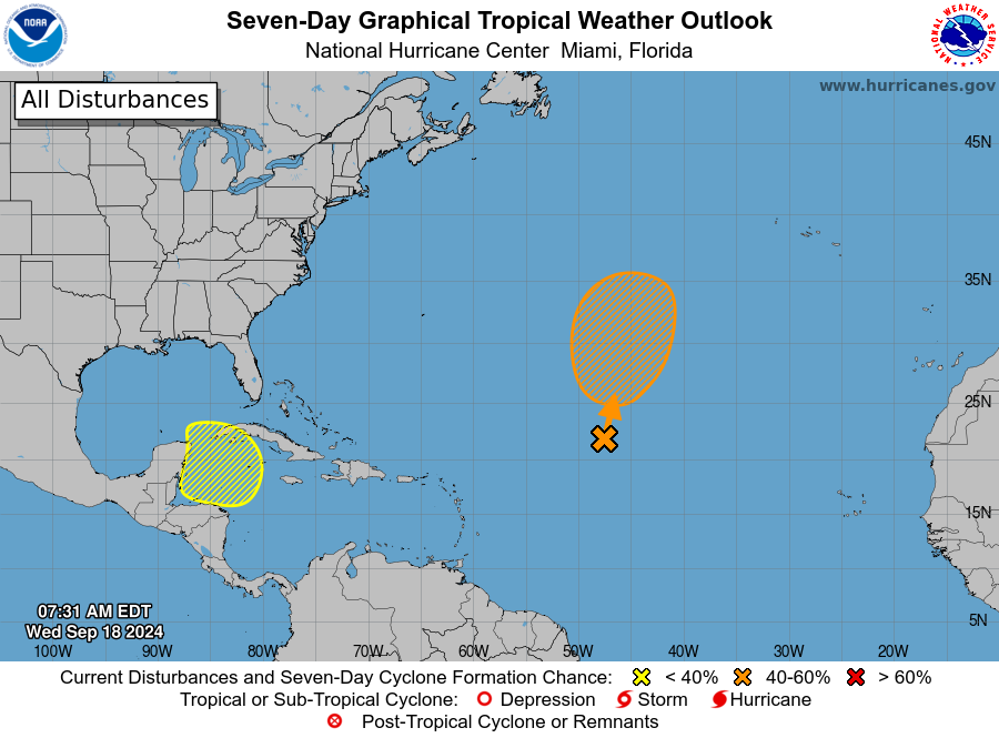
The NHC is monitoring an area a few hundred miles off the coast of the Carolinas. Each of the reliable computer models organize it into a named storm over the warm waters of the Gulf Stream toward the coasts of North Carolina and South Carolina and bring gusty winds, heavy rains with the potential for flash flooding Monday into Tuesday.
So the question is, what comes after that? Looking at long-range forecast models -- which become of lower confidence that farther out in time -- give a glimpse of what's in store for the rest of the season.
The GFS (American) model shows a tropical storm forming in the Caribbean, crossing Cuba northward and heading through the Bahamas just to the east of Florida around Sept. 24. The ECMWF (European) model shows that same cluster coming into southwest Florida as an unorganized (but likely very wet) tropical wave. More concerning is the Canadian model -- know for a long time for spinning up disturbances into strong storms -- has it forming into a Category 1 or 2 hurricane affecting South Florida before heading off into the Atlantic, around Sept. 24.
Keep an eye to the skies -- we'll keep you up to date on what you need to know at AroundOsceola.com!