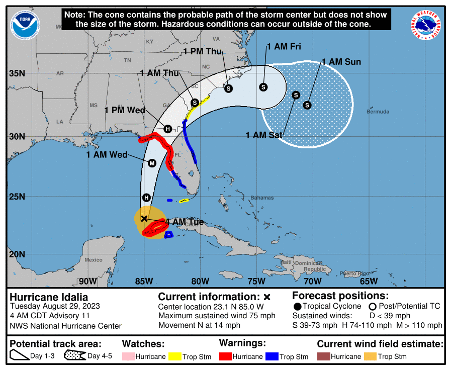
Tropical Storm Idalia became Hurricane Idalia at 5 a.m. Tuesday, and is expected to grow to a Category 3 major hurricane with 120 mph maximum sustained winds before it makes landfall in the area of Cedar Key in the Big Bend portion of north Florida.
So what does that mean for us here in Osceola County?
LIkely, we'll start seeing squally weather in outer feeder rain bands starting late tonight, and more frequent overnight and into Wednesday morning. Those squalls will be rapidly moving, and will have the tropical storm force winds of 35-45 mph imbedded in them. Those will have an outside chance of containing a short-lived tornado, so stay "weather aware" for the next 36 hours or so for local advisories.
The National Hurricane Center gives the Orlando area a 33 percent chance of getting 40-58 mph winds, mostly early Wednesday. Where there were 5-7 percent chances of higher winds in their probability package on Monday, there aren't any this morning.
So, your Tuesday routine can stay mostly intact -- Osceola County schools are open but after-school activities are canceled. Solid waste trucks are on the road this morning. After the evening drive time will be a good time to be home and monitor conditions. We'll know more about Wednesday then.