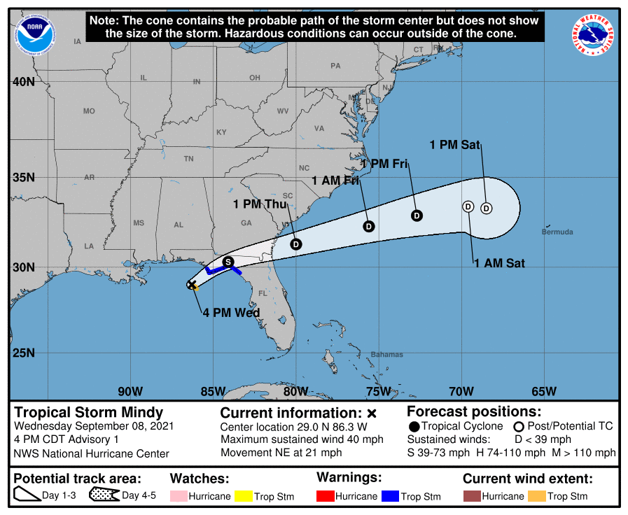
The National Hurricane Center named the storm after an area of disturbed weather in the northeastern Gulf of Mexico had gradually become better organized. We can expect an higher chance of rain tonight and tomorrow. #NHC #TropicalStormMindy #OsceolaWeather
At 5 p.m. EST, Mindy has maximum sustained winds of 40 mph, the minimalist of named storms, and was located 90 miles west-southwest of Apalachicola moving northeast at 21 mph.
"Little intensification is expected prior to landfall, with land interaction resulting in Mindy weakening back to a depression by 24 hours," the NHC said in its initial forecast discussion. Conditions do not appear favorable for restrengthening off the southeastern United States as shear is forecast to increase above 30 knots in 24 hours. This shear will likely strip away from remaining convection."
Mindy is expected to produce heavy rainfall from the Florida Panhandle into southern portions of Georgia and South Carolina through Thursday morning. This rainfall may produce isolated to scattered flash, urban, and small stream flooding.