Thinking that a storm off Florida's east coast means hitting the surf and waves? The National Weather Service in Melbourne is encouraging caution if that appeals to you.
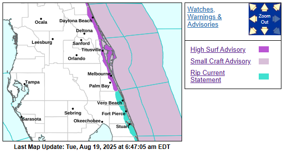
Building swells from Hurricane Erin are forecast to deliver multiple hazards for coastal and boating interests, including a "High Risk" for deadly rip currents through Thursday, and waves of 6-9 feet in the surf zone through at least Tuesday. Dangerous boating conditions will develop near inlets through Thursday, forcing a Small Craft Advisory as well from Flagler Beach to Sebastian Inlet.
"High surf will affect the beaches in the advisory area, producing localized beach erosion and dangerous swimming conditions. Swimmers should remain out of the water due to large breaking waves and dangerous surf conditions," the NWS' forecast for the Brevard and Volusia beaches starting Tuesday. "Entering the surf is strongly discouraged. Inexperienced swimmers should remain out of the water due to dangerous surf conditions."
Erin will also bring in a northeast breeze that could reach 25 mph; at least the wind itself will be dry, although those breezes could draw in brief showers later in the day. So it's a good day ... to enjoy your pool right here in Osceola County, and leave this weather to the experienced surfers who know the peril and what they're doing.
Surf advisories are in place up and down the eastern seaboard, as far north as Massachusetts. A Tropical Storm watch is in even in effect for Cape Hatteras and the outer banks of North Carolina, even though Erin will not make a landfall or direct hit, although its size and wind field are expanding.
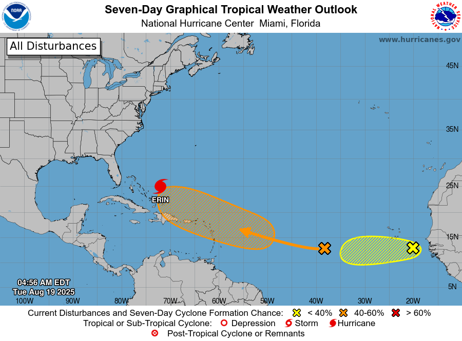
And ... keep an eye for what's behind it for a while. The National Hurricane Center is monitoring two central and eastern Atlantic waves for signs of development; they came from much the same area Erin formed. The central Atlantic has been given a 60% chance to developing into a depression over the next seven days and heading toward the Lesser Antilles; another near Cape Verde has been given a 30% chance of developing (and is now Invest 99L for monitoring). Long-range forecast models currently don't develop anything the size of Erin at this time. But, they are worth monitoring, which is what we do in Florida in August and September: watch the seas and skies.
Have a great Tuesday, Osceola! You're weather should be pretty good!