After a rainy pattern where most of Osceola County picked up 2-3 inches of rain since the start of the weekend, the pattern is set to change -- dramatically.
Rains that helped put a dent in dry drought conditions -- and helped contain a fire sparked by lightning in the Lake Lizzie area -- the sun will come out later today, and be in full force the rest of the week.
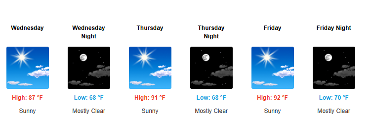
The small chances of a stray passing shower Tuesday afternoon will give way to sunny skies, as the low pressure system that traveled the Gulf has given way to a high pressure system that will bring dry air and plenty of sunshine. You know what that means -- temperatures that struggled to reach 80 degrees with all the cloud cover will rise ... dramatically. Temperatures in the mid 80s Tuesday and high 80s Wednesday, then welcome back the 90s with a vengeance.
That ridge of high pressure will lock in dry, sinking air, promoting cloudless heat. Temperatures are expect to reach low 90s by Friday and has high as 96 by the weekend and into Monday. While the trademark humidity we connect with the dog days of summer won't be present ... 96 is 96, people!
As the National Weather Service in Melbourne puts it: "Current forecast generally tops out in the mid-90s, a few degrees short of records. Moderate heat risk impacts expected across most of the area by the weekend. No mentionable rain chances."
So you wanted the rain to stop? Be careful what you wish for.
Have a great rest of the week, Osceola!