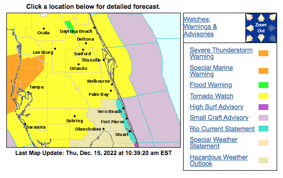
Osceola County is part of a large Tornado Watch in effect for much of Central Florida through 4 p.m. today ahead of a line of strong thunderstorms expected to come into the area later this afternoon.
What does this mean? As WESH-2 meteorologist Eric Burris puts it: "Conditions are favorable for tornadoes to form. The tornado watch means we need to WATCH OUT. If a warning is issued, that means it's happening... Be weather aware!"
The line is part of a cold front expected to bring some much cooler weather this weekend.
According to the National Weather Service in Melbourne:
"While the line itself will move toward the southeast, any storms will move quickly toward the east to northeast up to 35 to 40 mph and offshore. This activity will initially reach Lake and Volusia counties by late morning, and continue southeastward through east central Florida through the afternoon hours ...
"Primary storm threats will be frequent lightning strikes and strong to locally damaging wind gusts of 40 to 60 mph. However, an isolated tornado or two will also be possible. Small hail and locally heavy rainfall of 1 to 2 inches may occur with any storms as well."
Once we weather the afternoon, Friday and Saturday are expected to be more like December. Later tonight is expected to be mostly cloudy, then gradually becoming mostly clear, with a low around 54. The sun returns Friday, and highs through Monday will be in the 60s and lows around 50, with temps in the 40s Sunday night.