Osceola County in northern edge of Tropical Storm Warning
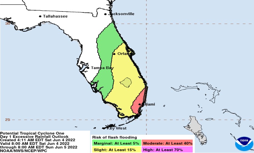
Rain should begin to taper off into the afternoon, thanks to a tropical system that has remained Potential Tropical Cyclone #1 -- and not Tropical Storm Alex.
Why? No closed circulation. The system is simply a handful of small vortices rotating around a broader center of circulation. The system actually abandoned its original low-level circulation, and a new one is forming over the Florida east coast, ready to race off northeast in the direction of Bermuda.
"While a cluster of convection is occurring near the center, the system is still not organized enough to be called a tropical storm," National Hurricane Center forecaster Jack Beven said in the NHC's 11 a.m. update.
While parts of South and Southwest Florida have seen as much as 10 inches of rain this weekend -- parts of Miami are under curfew as more emergency calls for trapped cars on roadways have come in than there are responders in some areas -- Osceola County can expect about 1-3 inches, with 5 inches possible in far southern Osceola.
Per the Osceola County Office of Emergency Management, localized flooding is possible.
Now is the perfect time to make finalize your hurricane season plans — the season runs through November, with its peak from late August to mid-October — and to finish purchasing any necessary items for your storm prevention kit. Many of those items are sales-tax free through June 10.
Other storm preparedness tips can be found at http://readyosceola.org