

While we just had a near perfect weather weekend, and today (Monday) is much the same, forecasters warn Wednesday, particularly midday, could bring gusty winds ahead a line of strong storms associated with a cold front.
The National Weather Service in Melbourne calls it "A strong cold front for March" that is forecast to bring increasing shower chances and isolated lightning storms Wednesday into Wednesday night.
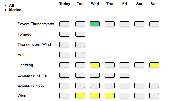
"A few strong to marginally severe storms will be possible ...The strongest storms which develop will be capable of frequent lightning strikes, damaging wind gusts up to 60 mph, coin-sized hail, and locally heavy rainfall. An isolated tornado threat will also exist. Breezy southwest winds develop Wednesday ahead of the front, with frequent gusts between 25-30 mph."
Ahead of the front, and thanks to the warm southwest winds, the high could reach 84 before the front, storms and a northwest wind cools things off quickly.
This same system is expected to bring hazardous weather to parts of the "ArkLaTex" in the Southeast tonight into Tuesday morning.
Until then here in Osceola County, expect a pleasant Monday and Tuesday with plenty of sunshine and highs in the low 70s, and lows in the low 50s. And, after the front moves through, expect it to be much cooler on Thursday with highs in the mid 60s to low 70s, the NWS says. A warming trend is then forecast into the weekend with highs returning to the 80s on Saturday. The next cold front looks to move across the area Sunday.
