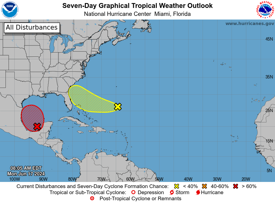
You knew the National Hurricane Center would eventually "break out its crayons" to start monitoring areas of potential development the storm season.
The storm center is watching two areas that could develop in the next seven days, including an area of low pressure expected to form northeast of the Bahamas and potential track toward Florida or the southeast U.S. coast. The NHC gives it a 30% chance of becoming a depression over the next seven days.
"Environmental conditions could be conducive for some development of this system thereafter while it moves westward or west-northwestward. The system is forecast to approach the coast of the southeast United States on Thursday or Friday," the NHC said in its Monday morning Tropical Weather Outlook.
In latest model runs -- which can be rather rough or uncertain until a low forms -- the GFS picks up on a tropical depression or a weak tropical storm forming late this week, Thursday or Friday, near the Georgia or South Carolina coast. The European model -- GFS or European are model names you may have heard of in past storm seasons -- doesn't pick up on development, but does have a low forming and moving across Florida Thursday into Friday, which would increase our rain chances by then.
Since a potential low in the Bay of Campeche and southwest Gulf of Mexico, which has higher chances of developing by Tuesday then heading into Mexico or South Texas, would develop first and get the first 2024 storm name Alberto, if the Atlantic low does become a tropical storm, it'd become Beryl.
Forecasters say a high pressure system in the north Atlantic, which could serve as a "heat dome" and bring very hot weather for the Northeast this week, would push any developing western Atlantic system west instead of curving north. It's an odd weather pattern for June -- and would be a concerning scenario in August or September, when development would be faster and bigger.