
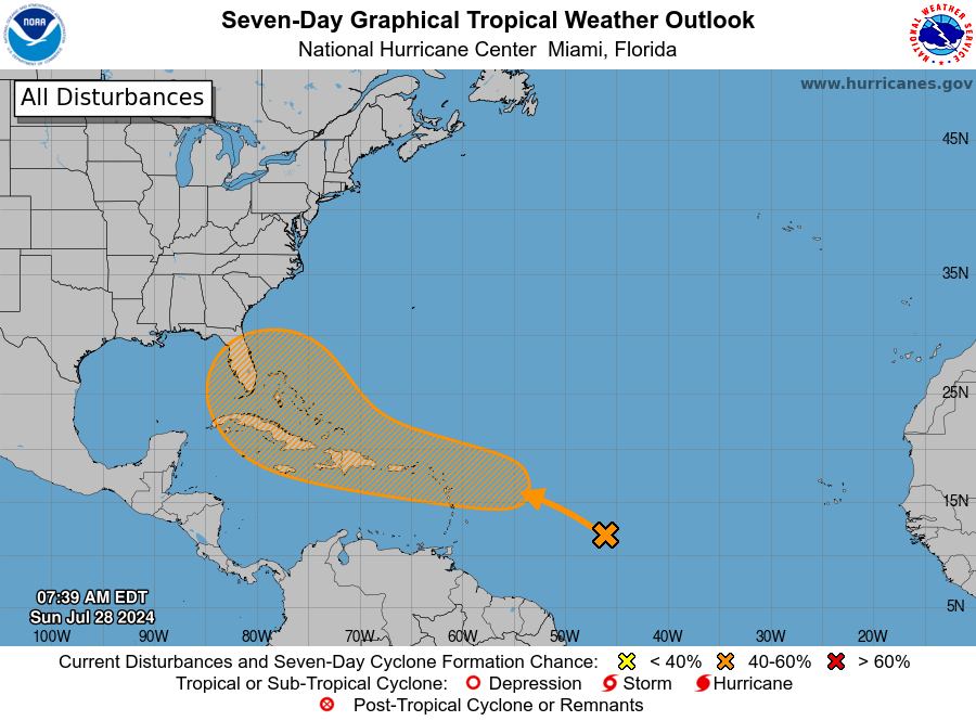
It's been quiet since Hurricane Beryl rocked parts of the Caribbean and Texas nearly a month ago, but the tropics are heating up again: the National Hurricane Center has started to monitor a tropical wave east of the Lesser Antilles that could develop and make its way in the general direction of Florida.
According to the NHC, the disturbance "Is expected to interact with an approaching tropical wave during the next several days. Environmental conditions are forecast to become conducive for some development in a day or two, and a tropical depression could form around midweek while the system is near or over the northern Leeward Islands, Greater Antilles, or southwestern Atlantic Ocean."
As of Monday morning, the NHC gives the system a 50 percent chance of developing over the next seven days. Any formation may take a few days, forecasters say, because the low is currently in an area heavy with Saharan dust and drier air.
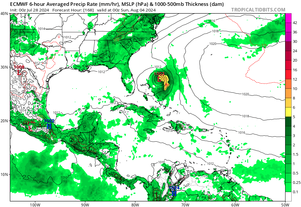
After hinting at development during the weekend, some computer forecasting models are picking up on this forming. The ECMWF (European) model shows a tropical storm developing in the Atlantic near the Bahamas and just east of Florida by next weekend, but shows it recurving into the open ocean, or affecting the Atlantic coast north of Florida. (Keep in mind this is at 168 hours; anything outside of 120 hours or five days should be taken as speculation and of low percentage confidence.) The GFS (American) model has yet to pick up on development and brings an area of wet weather toward the northern Gulf coast at the start of the following week.
The next storm name on the 2024 list would be Debby.
Either way, we've been promised a storm season with above-average activity, and now is a good time to check on your storm survival supplies: bottled water, flashlights, batteries, canned food and propane or charcoal for grills.
If this becomes a potential problem for Florida and Osceola County, we'll let you know here at AroundOsceola.com!