The National Hurricane Center is the authority on identifying and tracking named storms and hurricanes, and the seedling low-pressure centers that they form from. Local news outlets and national networks all use the NHC’s graphics and projections in their coverage, particularly when a storm nears land.
The center, based in Miami, makes all of its advisories, graphics and projections available on its website (www.nhc.noaa.gov, or simply www.hurricanes.gov). Here’s a guide to what is on there and where to find it.
The NHC provides tracking and analysis for storms in the Atlantic Ocean, as well as the Eastern Pacific (coast of Central America and Mexico and points west) and the Central Pacific (areas surrounding Hawaii). Daily, even when there are no formed storms, the NHC puts out a Tropical Weather Discussion, an overview of any stormy areas and the general weather conditions in the ocean basins, four times a day (2 and 8 a.m. and p.m.). It also issues a Tropical Weather Outlook at those same times, detailing systems of concern and their formation chances – if there are none, the NHC issues a pleasant note of “Tropical cyclone formation is not expected within the next 48 (or 120) hours.”
When a storm forms, a handful of products become available, such as:
Public advisory – an update issued at 5 and
11 a.m. and p.m. daily (with intermediates at 2 and 8 a.m. and p.m. once any watches or warnings are issued) with the position, relation to its closest location, maximum sustained winds and current pressure, a list of the watches and warnings and the hazards that will affect land, if applicable.
Forecast advisory – the area where storm-force winds will occur; used mostly for shipping interests in the waters of the area near the storm.
Forecast discussion – A narrative of what’s going on with the storm written by an NHC forecaster. While it can read like a science book, forecasters often put what’s going on in “layman’s terms” so it’s understood.
Wind speed probabilities – The percentages a location or city will get tropical storm or hurricane force winds, and when.
Then there are graphics that give a picture look at some of that information, including:
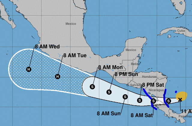
The famous “cone of the path of projected movement” – which the NHC says will be about 4 percent smaller than it was in 2021;
Wind speed and storm surge probabilities;
Arrival time of tropical storm-force winds;
A history of a storm’s winds;
Marine warnings in waters were a storm is located;
Key messages about the storm and its impacts, delivered in English and Spanish.