Hurricane Season 2025 has awakened; at the end of the week where two weak, brief tropical storms Andrea and Barry formed in the Atlantic and Gulf, and the Pacific basin reached its 'F' storm, the National Hurricane Center has noted the potential of some tropical development in the northeast Gulf of Meximerica toward the end of the upcoming week -- meaning Mother Nature may provide her own "rockets red glare" in the skies during Fourth of July.
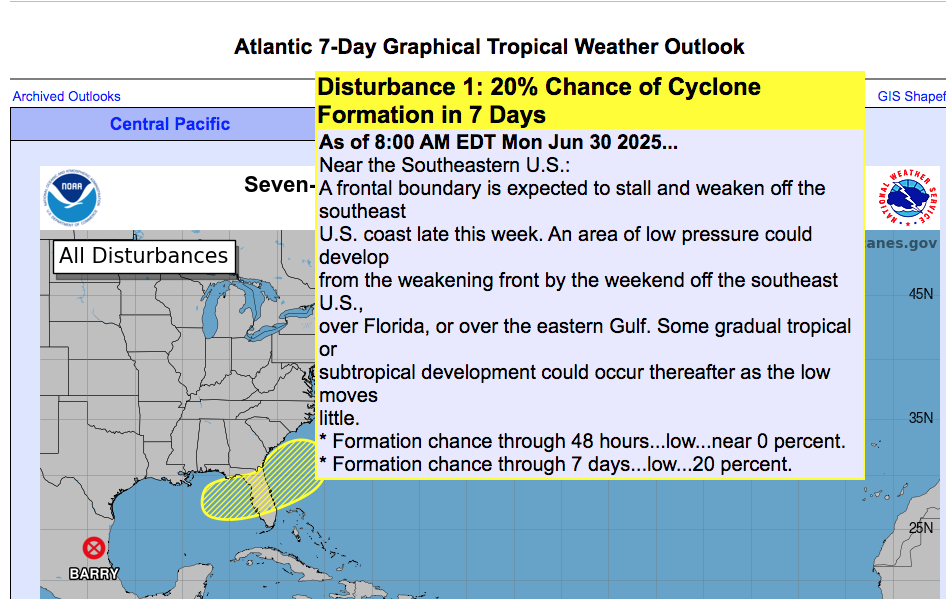
"Towards the end of this week into next weekend, an area of low pressure could develop from a remnant frontal boundary near or along the southeastern U.S. Atlantic and or Gulf coasts. Some gradual tropical or subtropical development could occur thereafter as it drifts slowly just off the U.S. coastline," is the word from the National Hurricane Center, which gives a 20% chance of formation through the next seven days (it would be at the end of the period, there's next to no chance of it in the next 48 hours.)
The GFS and European tropical models show, at most, a possibility of wet and messy weather -- what we basically see around the end of June and early July, with moist and humid conditions that often lead to afternoon summer thunderstorms. The Canadian model does show the formation of a weak low pressure center off the Georgia coast on Friday (the 120-hour forecast, they aren't the most reliable).
Our "normal" summer pattern of "hot, humid and wet" is already supposed to be in place this week, so keep an eye to the skies, especially in the late afternoon and early evening.