

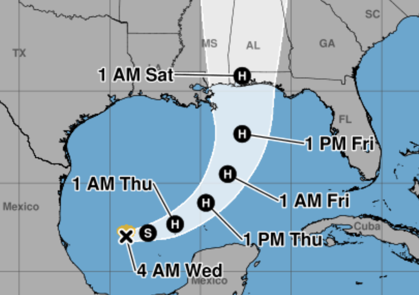
After a longer wait than usual to form, the first hurricane of 2026 is expected to form over the next day or two and threaten the northern Gulf Coast in an area from Grand Isle, Louisiana to Pensacola Friday into the weekend.
Overnight, Tropical Depression 9 became Tropical Storm Isaias (pronounced Is-I-EE-ess) formed in the southwestern Gulf of America, and while it is a weak storm now the National Hurricane Center forecasts to develop into a Category 2 hurricane. The center of circulation is expected to strike in an area between Pascagoula, Miss. and Moble, Ala., but the storm will inundate the whole U.S. Southeast with 6-8 inches of rain; the area is already soggy to soppin' wet with days of rain already this week.
Hurricane Watches will likely be required for a portion of that later today, forecasters say.
"Vertical wind shear then increases quite dramatically in the final 24 hours before the cyclone reaches the northern Gulf coast, though it is looking more likely that Isaias will be a significant hurricane when it reaches the coast," NHC Hurricane Specialist Phillipe Papin said in the storm's 5 a.m. discussion.
So what's that mean for us? The current soggy pattern will continue Wednesday and Thursday as an old stalled-out cold front is draped over the area, but the circulation from Isaias will bring a southerly wind, and a few of its outer rain bands will quickly move through the area. It means the weather for Friday night football could be ... interesting. While the rainy weather from Tuesday will persist Wednesday and Thursday, Friday will remain overcast but expect off-and-on rain that can get squally at times, but it should not feature much (if any) lightning.
But the storm's circulation could help clear the skies by Saturday into Sunday to provide a nice change of pace, although the winds will be warm out of the south.
So stay informed, keep an eye to the skies ... and keep the umbrella and rain jacket handy.
