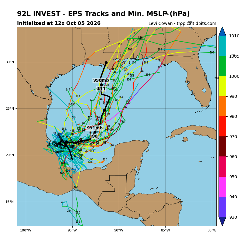
What's hurricane season in Florida without keeping an eye on the Gulf of America this time of year?
After a quiet 2026 season that's seen zero hurricanes form and just two tropical storms make landfall on the northern Gulf Coast, that area could see action again as a building trough of low pressure over the southwestern Gulf of America is producing disorganized showers and thunderstorms.
As forecast models show a storm could form and threaten an area from the Florida Panhandle to east Texas by the end of the week or the weekend, National Hurricane Center forecasters are watching the area for development.
The NHC gives the area of weather, now designated Invest 92L a 60% chance of forming into a depression (or more) through Wednesday, and an 80% chance by the end of the week.
"It is too early to determine the specific impacts to the northern Gulf Coast, but interests there should closely monitor the progress of this system," NHC forecaster John Cangialosi said in Monday's Tropical Weather Outlook. "This system is expected to drift eastward over the next couple of days, before it turns northward."
While water temperatures in the Bay of Campeche are plenty warm enough to support a storm forming — and Monday is the two-year anniversary the storm that became Hurricane Milton formed in the same general area — wind patterns show higher shear in the northern Gulf that would — should — tamp down any significant development.
The various computer models show at least a system that brings heavy rain moving north to northeast into the Southeast U.S. by the weekend. The American GFS model is doing what some hurricane watchers call the "GFS-icane", which shows the storm — which hasn't even formed yet, by the way — reaching the Mississippi coast early Saturday as a Category 1-2 storm.
It's name would be Isaias (Ee-si-EE-es), the same name of a 2020 Category 1 hurricane that threatened and approached the Florida East Coast before skirting north into the Carolina.
So what's this all mean for us? Central Florida already has a stalled-out front sitting over it, creating a wet pattern, and those who've been in the parts for a while, at least when a named system is in the Gulf, know it creates additional unstable weather, so expect a damp forecast for the rest of the rest as the atmosphere sorts itself out.
We'll update this again tomorrow when the outlook comes clearer.