For the first time in 25 years, the City of St. Cloud is updating its Future Land Use (FLU) map.
It has been a contentious process.
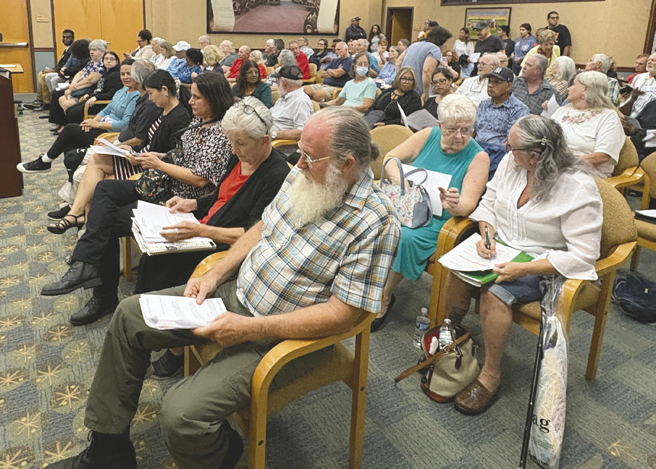
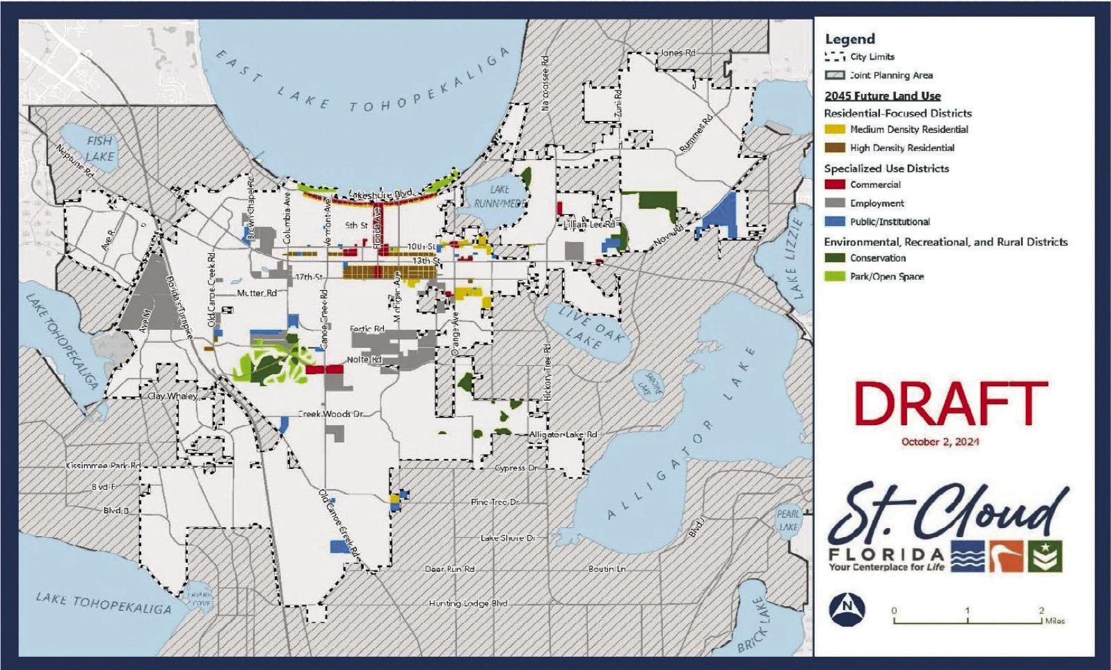
Over 200 residents packed a city Planning Commission meeting on Aug. 19, and many of them spoke out against changes proposed, including allowing high-density residential in the “state street” grid, and low-intensity “neighborhood commercial” on Florida Avenue. A section of Lakeshore Boulevard in the vicinity of the boat ramp and Crabby Bill’s restaurant would also be assigned a neighborhood commercial land use.
Two days later, on Aug. 21, the City Council workshopped the proposed changes.
The last adopted plan, which was approved in 2000, underestimated the City’s population by 20,000 and the housing demand by 10,000, according to the city Community Development Director Melissa Dunklin. VHB planner Jared Jones cited the larger population increase and lag in local job creation as creating a deficit of only 0.57 jobs per residential rooftop in the city, 40 percent less than the desired ratio of at least one local job per household.
“The new data says that St. Cloud needs 17,000 more housing units by 2045,” he said. “Proactive planning here is the best way to adjust this growth, and that’s what we’re proposing.”
While many of the proposed changes were “map cleanup” items—correcting details that had been previously overlooked—some of the changes had been discussed with residents in that contentious Planning Commission meeting.
An earlier FLU map circulated by the city had shown a change to medium-density residential zoning along most of Lakeshore Boulevard, within the city limits. This land use would permit duplexes, townhouses, and multi-family dwellings such as apartments or condominiums; however, at the start of the meeting, it was announced that the map depiction was in error.
Urban planning is not an easily understood subject for most, filled with a variety of acronyms and multiple layers placed over a single piece of property. Each property has both an underlying land use, then zoning, and possibly other designations such as historical.
A less-than-perfect analogy would be to apply urban planning principles to planning a dinner. For example, you would first have to make a generic choice for the main course. Let us use “meat” for the entrée. This corresponds to land use. Then select “beef,” which represents the zoning. Finally, we select how we want to prepare our beef: grilled steak, beef stew, or meatballs for spaghetti. This is the engineering necessary for what we want to develop on our property.
In addition to comments related to high density and commercial property, several residents spoke up about the need to address specific issues happening now, including traffic congestion in general, unsynchronized new traffic lights on U.S. 192, and the continued location of schools on major roads, which were cited for both slowing traffic during peak periods and adding additional congestion twice each day to already limited roads.
In response, the city staff’s message seemed in essence to say that the city needed to grow its way out of the current situation by creating more jobs to achieve the minimal 1-to-1 rooftop to job ratio.
After a number of motions, the four members of the Planning Commission present deadlocked in a 2-2 vote to make a positive recommendation to the City Council.
“I really did listen to your comments and your concerns, and we restructured this presentation to try to address some of those concerns directly,” Jones said at the Aug. 21 meeting.
Despite earlier talk of deeming areas near the St. Cloud Lakefront as commercial future land use, feedback from the community contributed to that idea being downgraded to a newly created “neighborhood commercial” future land use, which would be limited to restaurants, cafes, and bed-and-breakfasts, only between Massachusetts and Michigan avenues.
“We’re talking about something that’s going to complement the neighborhood,” Council Member Kolby Urban said. “It’s not like we’re building a Super Walmart. I’m a big believer in commercial. We need jobs. We need places for people to visit when they visit our beautiful natural resources in the city.”
Staff will continue to make corrections and changes to the map before Council votes to adopt it.
“This is a living, breathing document, and we can continue to make any updates as requested or are directed by Council until it’s adopted by Council,” Dunklin said.
To review the city’s draft land use plan, see http://bit.ly/41RyKJG. The first Public Hearing on the FLU by the council will take place at the regular council meeting on Thursday, Sept. 11.