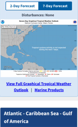
The National Hurricane Center has debuted a mobile-friendly front page to its website, hurricanes.gov/mobile, in 2026. (Photo/NHC)
The National Hurricane Center has changed or updated some of its forecasting tools, products, and presentations for 2026.
One of them has already been used, adding a color to its “crayon palette” of marking potential areas of development with a yellow, orange or red ‘X’ and hatched areas depending on their chance of impending development.
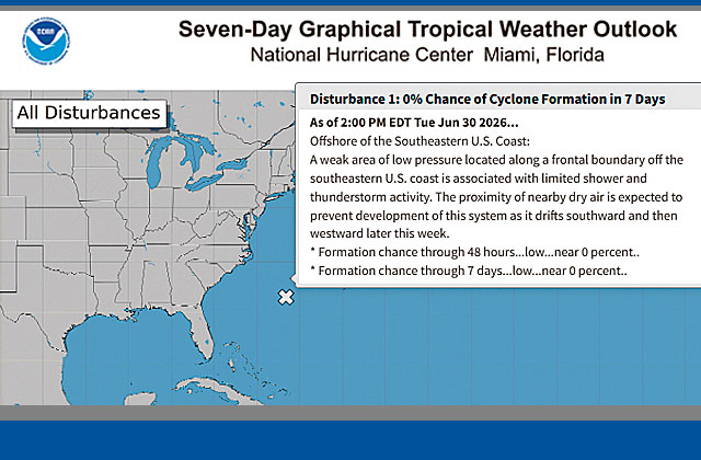
During June, the NHC watched a low-pressure area off the Atlantic coast of the Carolinas. In previous years, the Graphical Tropical Weather Outlook has depicted all systems with a low chance (less than 30%) of development as a yellow X, including systems that had a near 0% chance in both the 2-day and 7-day forecast periods. Beginning in 2026, systems in which development is not expected (near 0% in both 2- and 7-day forecast periods) will be depicted as a gray X, like it did with its area to watch in June, like it did with the June watched area as it became clear that it would not develop and was “on its way out”.
For those who are fans of the NHC’s “cone” to depict a storm’s path of projected movement and the potential errors in the track at extended periods, the NHC reports that the size of the tropical cyclone track forecast error cone for the Atlantic basin in 2026 will be about 4–8% smaller as compared to 2025.
The cone represents the probable track of the center of a tropical cyclone, and is formed by enclosing the area swept out by a set of imaginary circles placed along the forecast track (at 12, 24, 36 hours, etc.). The size of each circle is set so that two-thirds of historical official forecast errors over the previous five years (2021-2025) fall within the circle. The circle radii defining the cones in 2026 will shrink slightly at points from 36 to 120 hours out.
The NHC also has debuted a mobile-friendly front page to its website, hurricanes.gov, that is more mobile friendly and more accessible. As a first step, a refreshed version of the front page of the NHC website will be hosted on NHC’s mobile URL (https://www.nhc.noaa.gov/mobile/) around the beginning of the 2026 hurricane season. This version will work on mobile, tablet, and desktop devices.