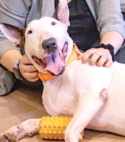
“Trooper” PHOTO/FRESH TAKE FLORIDA
Owner of dog abandoned tied to pole on I-75 in Milton arrested
Valentina Sandoval
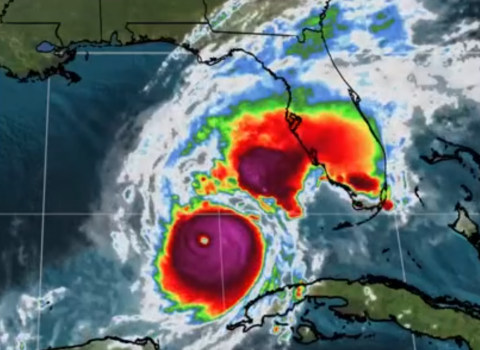
Gov. Ron DeSantis said authorities have started criminal proceedings against the owner of the bull terrier found abandoned and tied to a pole on Interstate 75 ahead of Hurricane Milton’s landfall.
Friday, October 25, 2024