Hurricane
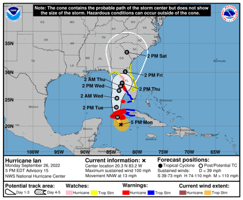
The 5 p.m. cone of projected movement for Hurricane Ian, now a Category 2 storm with 100 mph top winds. GRAPHIC/NHC
5 p.m. update — Ian now Category 2; Flood watch in effect; states of emergency in place
Residents work to fill sandbags Monday morning at Osceola Heritage Park ahead of Hurricane Ian. The area could receive 4-8 inches of rain. PHOTO/KEN JACKSON
Monday 11 a.m. Hurricane Ian update — still Category 1; Osceola among counties under Tropical Storm Watch
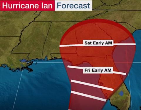
The National Hurricane Center now expects Hurricane Ian to be just off the west coast of Florida from Tampa Bay to Cedar Key. GRAPHIC/THE WEATHER CHANNEL
Morning update: HURRICANE Ian; models edging east and hurricane watches up for Tampa Bay area; what to expect and when
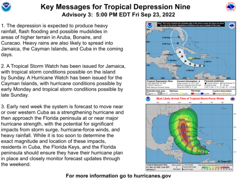
Potential storm Ian pushes governor to issue emergency declaration for 24 counties, including Osceola. GRAPHIC/NHC
5 p.m. updates — this will be Ian; Osceola part of 24-county state of emergency declaration; track nudges slightly west
GRAPHIC/NATIONAL HURRICANE CENTER The National Hurricane Center is the source for storm graphics, including the infamous “cone of projected movement” that is disseminated by other media outlets.
How to use the Hurricane Center website
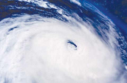
PHOTO/METRO It can take just a matter of days for a hurricane to form if the temperature is warm and there is a lot of water vapor rising from the ocean.
The science behind hurricanes
How businesses can prepare for natural disasters
PHOTO/METRO Before you ever have to make a storm claim, get familiar with certain policy details like your deductible and how your payout is calculated.