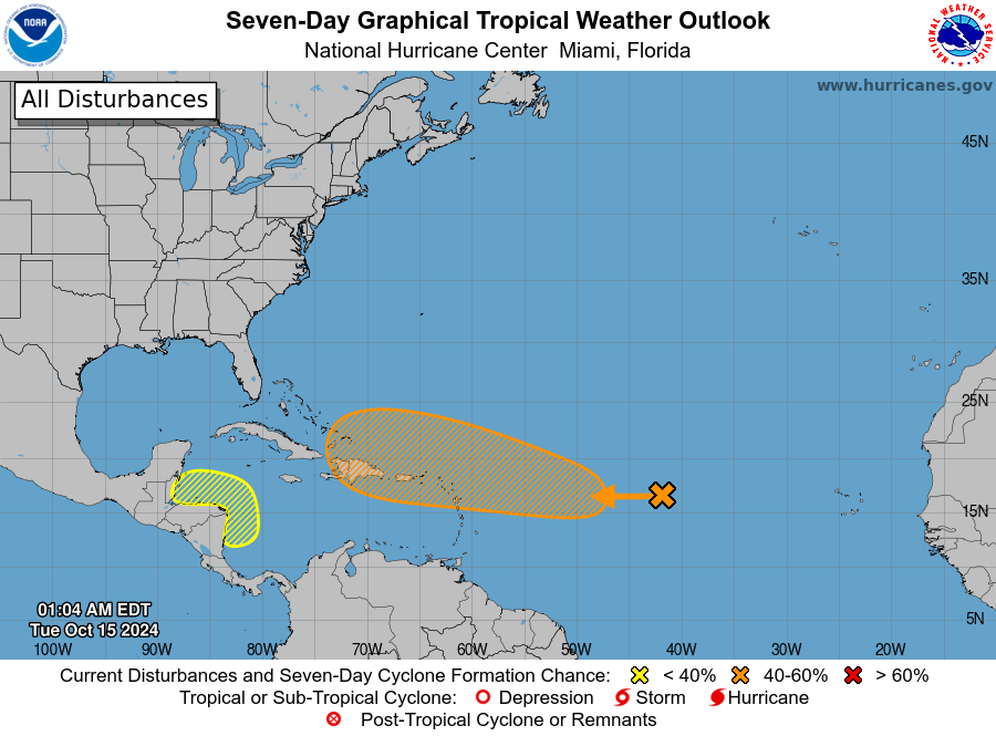

"A well-defined area of low pressure located over the central tropical Atlantic is producing occasional showers and thunderstorms ... this system is forecast to move generally westward and environmental conditions are expected to become more favorable for gradual development by the middle to latter part of this week."
Storm-weary Floridians who have endured three hurricanes in the 2024 are edgy, and probably don't need to hear that or see a map with a disturbance moving toward the state.
But here's two words that mean we here shouldn't have to worry about another tropical system impact:
Cold front.
A front that is moving through our area this week, and another in about another week, will generate steering currents that would push anything that forms out of this disturbance to the north and east. That is the solution that a number of the reliable forecasting models, like the GFS (American), ECMWF (European) and CMC (Canadian) provide. While some forecast a modest tropical storm forming near Hispaniola or eastern Cuba, each show it then moving off to the northeast into the Atlantic.
There is also an area of disturbed weather forming in the same area that Hurricane Helene generated. But all storm models have anything that forms moving west into Central America and also posing no Florida threat.
So breathe easy, and if anything changes, we'll be the first to let you know.