Some Osceola County residents will have a new county commissioner representing them in 2021.
Based on the 2020 Census, which was finalized a little late this time around due to the pandemic, County Commission districts are shifting slightly in order to keep a balanced population among the five of them. This occurs every 10 years.
For perspective, when this was last done in 2011, there were roughly 53,000 residents per district. In 2021 there will be 78,000 per district.
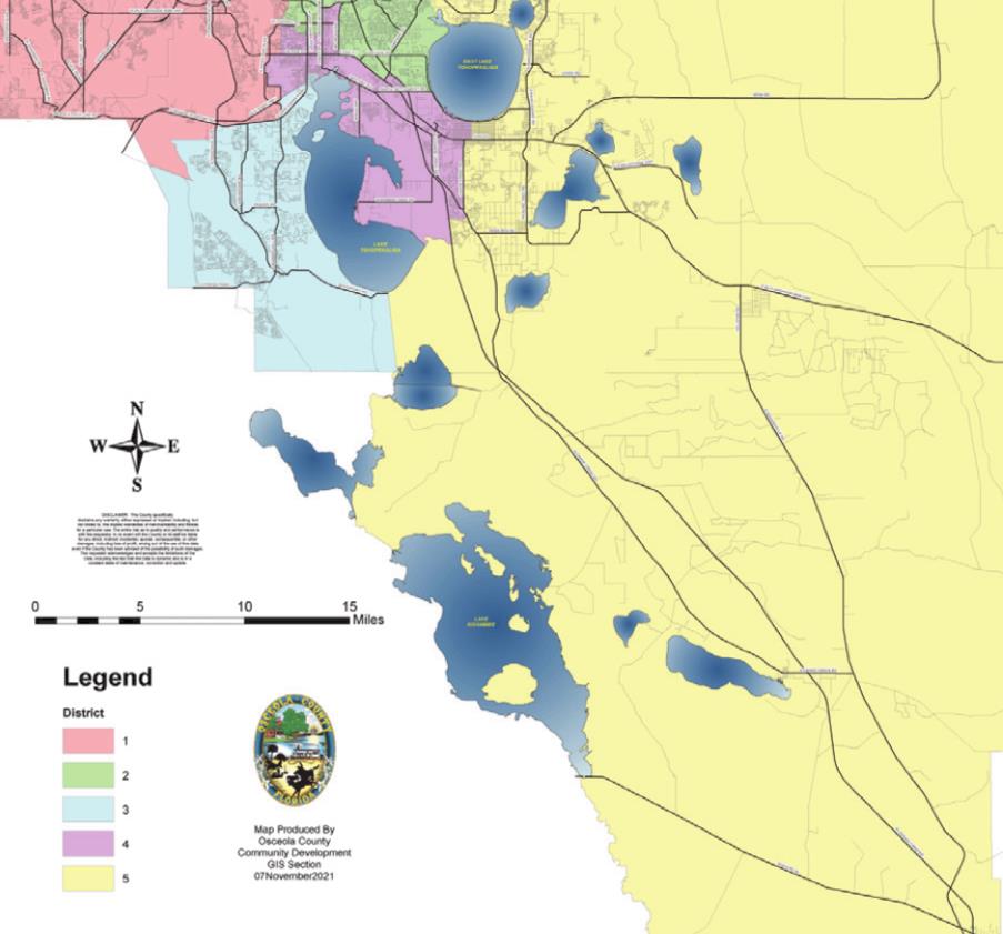
That growth required making Districts 1 and 5 smaller and expanding the footprints for Districts 2 and 4. District 3 saw modest changes to its boundaries.
“Redistricting is a necessary process to reflect changes in our community. I’m thankful for citizens who took time to examine the issue and for staff that sweated the details,” said Osceola Commission Chairman Brandon Arrington. “Our new districts meet all the legal requirements and also make common sense. It’s important to get it right because district commissioners are the closest representatives that voters have to so many decisions that impact their lives.”
Here’s a breakdown of the changes:
District 1
Peggy Choudhry
John Young Parkway/Orange Blossom Trail now forms a southern boundary of this district, as does Hoagland Boulevard (the western edge of the city of Kissimmee). This district will lose some areas to Districts 2, 3 and 4.
District 2
Viviana Janer
Now includes neighborhoods between Thacker Avenue, Donegan Street, and Orange Blossom Trail, and between OBT and Carroll that were once part of District 4. Also now includes Osceola Heritage Park.
District 3
Brandon Arrington
Now extends north to John Young to include neighborhoods along Poinciana Boulevard, Ham Brown Road and Pleasant Hill Road, including Broadmoor, Orange Vista, Campbell City south of JYP, and The Forest. Now includes all of the Oaks and the neighborhoods north of it south of downtown Kissimmee, and the upcoming Lancaster Ranch park project.
District 4
Cheryl Grieb
Now includes what’s north and east of the “Old Hoagland” configuration just west of the Kissimmee airport, and now stretches west to Dyer Boulevard bordered by Vine Street, Donegan and Carroll. South of St. Cloud, it now includes the Deer Creek and Canoe Creek Estates neighborhoods.
District 5
Ricky Booth
He gets what’s left. Includes about half of the “state street” grid already served by the City of St. Cloud, everything east of Canoe Creek Road, north and east of East Lake Toho along Boggy Creek and Narcoossee Roads, and south and east to the county borders.
To see the newlyadopted districts map, go to https://bit.ly/3yjpu1g.
Keep in mind that those who live in the city limits of Kissimmee or St. Cloud are served by services of those cities.