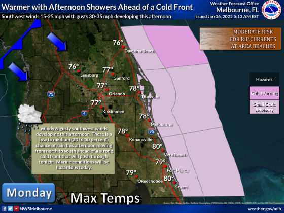
Monday is the last day for warmer temperatures for a little while, with afternoon temperatures today slightly above normal for this time of year ahead of a few storms with an approaching cold front in the late afternoon or early evening. GRAPHIC/NWS MELBOURNE
Today's weather is going to be best described as changeable as a moody teenager.
A warm and breezy afternoon is forecast to give way to a chilly to downright cold evening and crisp afternoons for a good portion of this week. (Rapidly changing weather after we all got back from visiting all kinds of family and friends for Christmas ... and you wonder why a lot of people are sick? Pound that Vitamin C, folks.)
While the high temperature today will reach about 78 degrees this Monday afternoon, the approaching front will whip up the breezes to 20-25 mph, but out of the south to keep things warm, per the National Weather Service. Sometime in the 4-6:30 p.m. timeframe -- yes, the afternoon drive time -- the front arrives and will bring some quick rain and the possibility of a brief strong thunderstorm.
But once thee front moves through, the wind will shift around to out of the north and still brisk. Temperatures overnight and into Tuesday's sunrise are forecast to approach 40 degrees. The NWS forecasts a low of 39 for Orlando, meaning low-lying Osceola pockets could go a bit lower, and wind chills around sunrise Tuesday, forecast to be the coldest of this week, could reach freezing (32) in Kissimmee, the NWS forecasts.
The NWS has issued a Cold Weather Advisory for areas to the north and west of Osceola County. And the cold air is forecast to linger, with highs through Thursday struggling to get into the low 60s.
The good news is things should warm up a bit by the weekend, with highs of 68 to 70 on Friday and Saturday, with lows around 50. An arctic blast that long-range forecasts hinted at last week -- the GFS model was forecasting lows in the low 20s for next weekend -- looks not to be coming together.