Question is — will it affect Osceola?
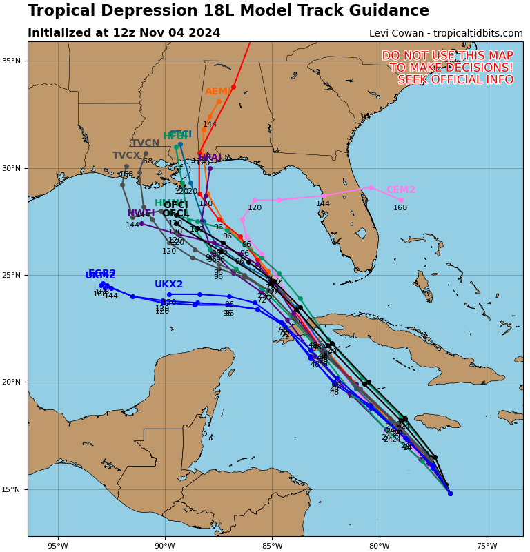
4 P.M. MONDAY UPDATE — The National Hurricane Center named Tropical Depression 18 as Tropical Storm Raphael at 4 p.m. EST, with top sustained winds of 45 mph and a central pressure of 997 millibars; down 6 mbs from the last update 6 hours ago. Tropical storm conditions are expected in Jamaica tonight and through tomorrow. It's forecast to be a Category 2 hurricane on its crossing of western Cuba.
Tropical storm watches are now up for the lower and middle Keys.
That's when we need to watch it very closely.
The area of low pressure that the National Hurricane Center has been watching for development in the western Caribbean for nearly a week now finally developed a closed center of circulation located about 200 miles south of Jamaica.
As of now, hurricane forecasters say it will continue through the central Gulf, moving northwestward toward Louisiana by the weekend. By that point, direction and intensity guidance begins to spread. Strong wind shear from the jet stream is expected to limit its formation, and the storm could wind back down to a tropical storm — or less.
On this track, if it doesn't change, Rafael would be hundreds of miles west of Central Florida. The storm could increase our local rain chance Thursday and Friday, and also kick up a modest breeze out of the south and southeast.
And, as a reminder that the hurricane season lasts until Nov. 30 — or when Mother Nature says so — the NHC is watching an area between Cuba and the Bahamas for possible small-time development the first part of next week. And the long range GFS American storm prediction model, which goes out to 16 days — the end of that period is of very low confidence — shows the potential of another hurricane forming in the Jamaica-Caymans-south of Cuba area around Nov. 19.