Hurricane

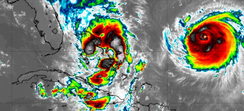
The presence of Tropical Storm Imelda and Hurricane Humberto (right) will affect our weather the first part of the upcoming week. (Photo/Tropical Tidbits)

The presence of Tropical Storm Imelda and Hurricane Humberto (right) will affect our weather the first part of the upcoming week. (Photo/Tropical Tidbits)

What to expect this week with Tropical Storm Imelda off the coast

While Osceola County will not see direct weather impacts (luckily) from either Hurricane Humberto out to sea or Tropical Storm Imelda rolling through the Bahamas, the storms in the Atlantic will have an affect on our weather, at least in the first part of this week.
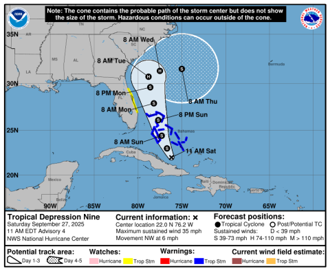
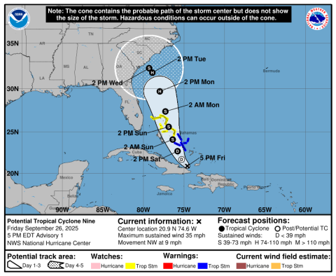
The NHC began advisories on Potential Tropical Cyclone Nine, located near the southeast coast of Cuba, at 5 p.m. Friday.

The NHC began advisories on Potential Tropical Cyclone Nine, located near the southeast coast of Cuba, at 5 p.m. Friday.

Nine's got Potential — Imelda-to-be bears watching for Florida

Tropical storm watches and warnings are in effect for the Bahamas as a disturbance the National Hurricane Center expects to develop is expected to move north and parallel the Florida coast through the weekend into early next week.
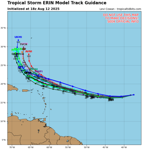
Reliable model output from Tuesday afternoon shows Tropical Storm Erin is currently forecasted -- but not mandated -- to curve northward east of the Bahamas but west of Bermuda. It is expected to be a Category 3 major hurricane at that time. (Graphic/Tropical Tidbits)

Reliable model output from Tuesday afternoon shows Tropical Storm Erin is currently forecasted -- but not mandated -- to curve northward east of the Bahamas but west of Bermuda. It is expected to be a Category 3 major hurricane at that time. (Graphic/Tropical Tidbits)

UPDATE — Erin forms in Atlantic, heading westward as a potential hurricane; where's it going?

TUESDAY 5 P.M. UPDATE — Tropical Storm Erin remains weak and headed on a westerly path. It is still forecast to become a hurricane, and long-range models are hinting that it may recurve to the east of the Bahamas into the Atlantic.
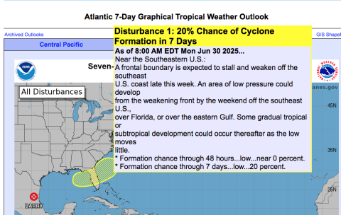
The National Hurricane Center has noted the potential of some tropical development in the northeast Gulf of Meximerica toward the end of the upcoming week. (Graphic/NHC)

The National Hurricane Center has noted the potential of some tropical development in the northeast Gulf of Meximerica toward the end of the upcoming week. (Graphic/NHC)

Tropical Trouble? NHC includes Florida in chance of late-week development

Hurricane Season 2025 has awakened; at the end of the week where two weak, brief tropical storms Andrea and Barry formed in the Atlantic and Gulf, and the Pacific basin reached its 'F' storm, the National Hurricane Center has noted the potential of some tropical development in the northeast Gulf of...
Citing above-average subtropical eastern Atlantic Ocean and Caribbean Sea surface temperatures as a primary factor, the tropical forecast research team at Colorado State University continues to predict an above-average 2025 hurricane season. (Photo/CSU

Citing above-average subtropical eastern Atlantic Ocean and Caribbean Sea surface temperatures as a primary factor, the tropical forecast research team at Colorado State University continues to predict an above-average 2025 hurricane season. (Photo/CSU

CSU researchers: prediction for above-average storm season remains

Citing above-average subtropical eastern Atlantic Ocean and Caribbean Sea surface temperatures as a primary factor, the tropical forecast research team at Colorado State University continues to predict an above-average 2025 hurricane season.
Milton brought down a tree near downtown Kissimmee. (Photos/Ken Johnson)

Milton brought down a tree near downtown Kissimmee. (Photos/Ken Johnson)

Don’t be tone deaf—be ready for the right things in a storm

Our friends to the north get four different temperate seasons.In Florida, we have seasons, but they’re not so much dictated by the weather.Starting in January, or maybe a bit earlier, they go: Tourist, Graduation, Hurricane and Holiday.