
While Osceola County won't feel the full force of soon-to-be Hurricane Debby, we will feel the expected effects of being to the east, or on the "right side" of the tropical system.
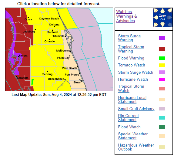
Osceola County is included in a tornado watch in effect until 8 p.m. Sunday, but is not included in the inland Tropical Storm watch that Polk, Lake and Marion counties are under.
Starting in earnest later Sunday afternoon -- a small, quick-moving severe thunderstorm just moved through the eastern portion of Osceola into Orange County just before noon -- the area will see feeder bands moving quickly through from south to north, bringing heavy rains at times and wind gusts of 30-40 mph, again from the south. Weather stations at Poinciana High School and Osceola Heritage Park have already had wind gusts of 25 to 28 mph Sunday.
Rain accumulations will likely be in the 3 to 6-inch range throughout the county through Monday afternoon. It's nowhere near the 17 inches received during Ian in 2022, but localized flooding is a distinct possibility.
These conditions will likely last into the late afternoon or early evening on Monday. Those who commute should take care in driving on Monday. No government entities or utilities have announced any Monday closures as of noontime Sunday.
The federal government has approved an Emergency Declaration for a portion of Florida that includes Osceola, authorizing FEMA to, "Identify, mobilize and provide, at its discretion, equipment and resources necessary to alleviate the impacts of the emergency."
Sunday will be a day to make a bowl a popcorn and check out some Netlfix with family -- while staying tuned into weather updates, and here at AroundOsceola.com.