
TUESDAY 11:30 A.M. — Ahead of the approach of Tropical Storm Helene — which was officially named at 11 a.m., Osceola County announced sandbag operations would be available for county residents to get bags at Osceola Heritage Park from 12-7 p.m. Tuesday. There is no word if it will continue into Wednesday (check back for updates).
"Based on observations, the County’s lakes and ponds have ample capacity to handle the expected rain," Osceola County's statement said. Bags will be provided, just bring a shovel or filling tool.. Residents are allowed 25 sandbags per household and will be available for filling on a first-come, first-served basis.
Residents are advised to re-use filled sandbags they have at home from distributions earlier this year, as sandbags that have not come into contact with water can be saved to be used in case of additional flooding.
Tropical Storm Helene current has maximum winds of 40 mph and was about 180 miles southeast of Cozumel, Mexico, moving northwest at 10 mph. It is expected to reach the southeastern Gulf of Mexico Wednesday as a hurricane, and is projected to make landfall in the Florida Panhandle or Big Bend area late Thursday night.
Much "bad weather" will be on the right side of the storm, to the east of it, so expect a Thursday of windy, squally weather. In the Tuesday 11 a.m. update, the NHC gave the Orlando area a 22 percent chance of receiving winds up to 50 mph through Friday.
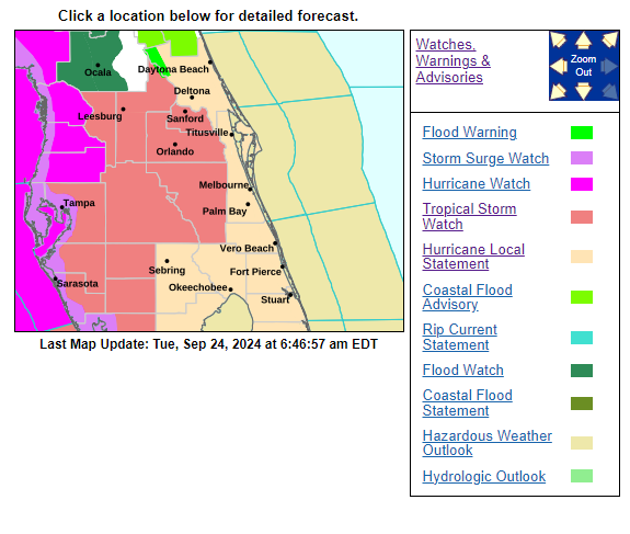
TUESDAY 8 A.M. — The National Hurricane Center now has watches up for the peninsula of Florida, and that includes Osceola County, which is under a Tropical Storm Watch, along with Polk, Lake, Orange and Seminole counties in our area. This is ahead of a storm currently in the western Caribbean expected to become Tropical Storm (and then Hurricane) Helene by today and affect the Florida Panhandle by Thursday.
A Tropical Storm Watch means tropical storm-force winds are possible in the area within the next 48 hours. While the center of the storm is currently expected (remember, the NHC's cone is a a projection of movement, rather than a roadmap of "the storm is going here") to be about 140 miles off the coast of Tampa as a strengthening hurricane when it passes our latitude, tropical storm-force winds are expected to reach out about 225 miles from the center by that point. Across Osceola County, higher winds are possible in the western parts of our area (Celebration, Champions Gate, Davenport), with a lesser chase across Kissimmee, St. Cloud and Harmony.
Per the National Weather Service in Melbourne, peak wind forecasts for our area are 20-30 mph, with gusts to 50 mph possible. Rainfall is expected to be 2-4 inches through Thursday with "locally heavier amounts" possible.
More from the NWS' local advisory:
"In addition to strong wind gusts, a few tornadoes embedded in rain bands are possible, mainly on Thursday, as the system moves northward ... Impacts from this tropical cyclone will be experienced far from the center of the storm. Now is the time to ensure your hurricane supply kit is stocked and your safety plan is in place. Additional changes to the forecast are possible. Eastward shifts in the forecast track would increase the potential for additional impacts locally, so continue to monitor the latest forecasts."
Potential wind impacts include:
- Damage to porches, awnings, carports, sheds, and unanchored
mobile homes. Unsecured lightweight objects blown about.
Many large tree limbs broken off. A few trees snapped or uprooted, but with greater numbers in places where trees are shallow rooted.
Some fences and roadway signs blown over.
Scattered power and communications outages.
Monday, Gov. Ron DeSantis declared 41 of Florida's 67 counties under a state of emergency. Those include all those bordering the Gulf Coast, and the northern one-third of the state, including the Panhandle. This did NOT include Osceola County.
SCHOOLS: Like other entities right now, the School District of Osceola County is in "monitoring" mode for the storm. Students are already scheduled for an off day Friday for teacher development.