
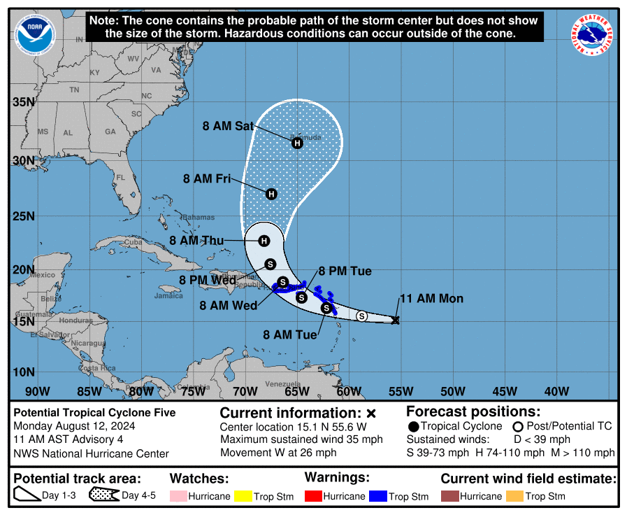
The National Hurricane Center has been watching a tropical wave for days in the Atlantic. While the fast-moving storm has not formed a "well-defined center", forecasters believe it will, and strengthen into a tropical storm by Wednesday, when its expected to reach Puerto Rico with 50 mph winds.
At 11 a.m. Monday, the storm was about 430 miles east of Antigua moving west at a speedy 26 mph. Operationally, it is Potential Tropical Cyclone 5, but Tropical Storm Ernesto is expected to form Tuesday as it traverses the northern Leeward Islands and Lesser Antilles. Those islands are expected 2 to 4 inches of rain and a slight storm surge.
From there, the storm is expected to reach the western edge of a ridge over the Atlantic Ocean. Forecasters expect the storm to turn to the north east of the Bahamas and Florida, and become a hurricane that could threaten Bermuda by Saturday.