Hurricane Debby rain bands continue -- and could linger into the evening, Tuesday morning
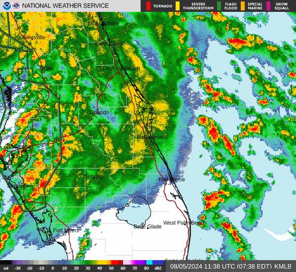
A Tornado watch remains in effect for Central Florida, including Osceola, until 4 p.m. Monday as the feeder rain bands from Hurricane Debby continue to roll into the area from the south during the day.
A tornado warning was issue for a storm with rotation in northeast Polk County early Monday morning as a tornadic cell moved from Polk into Lake County just to our west.
And, these storms may linger through the day. The storm is expected to turn to the northeast and linger across the Florida Panhandle and could take all day Monday into Tuesday just to cross into Georgia. Parts of the Georgia and South Carolina coasts may receive 16-20 inches of rain through the week. Parts of southwest Florida have received 10-12 inches.
Rain totals from Sunday into Monday across Osceola County have largely been in the 1-2 inches range. KUA hasn't reported any storm-related outages (https://kissimmee.datacapable.com/map/)
Debby made official landfall around 7 a.m. between Steinhatchee and Horseshoe Beach in the Big Bend area of Florida as a Category 1 storm with 80 mph top sustained winds. In a morning press conference, Gov. Ron DeSantis said the biggest issues for Florida have been storm surge and inundation and flooding.
"There is significant flooding from Sarasota and Bradenton into north Florida," he said. "We have a lot of flooding and water being dumped throughout the state, and we'll see the effects of that in the ensuing days. We have many resources ready to be deployed; we've probably marshalled more resources than we'll likely need."
A State of Emergency is in place in 61 Florida counties.
Florida FEMA Director Kevin Guthrie put the response to Debby succinctly.
"We are the best at what we do," he said.